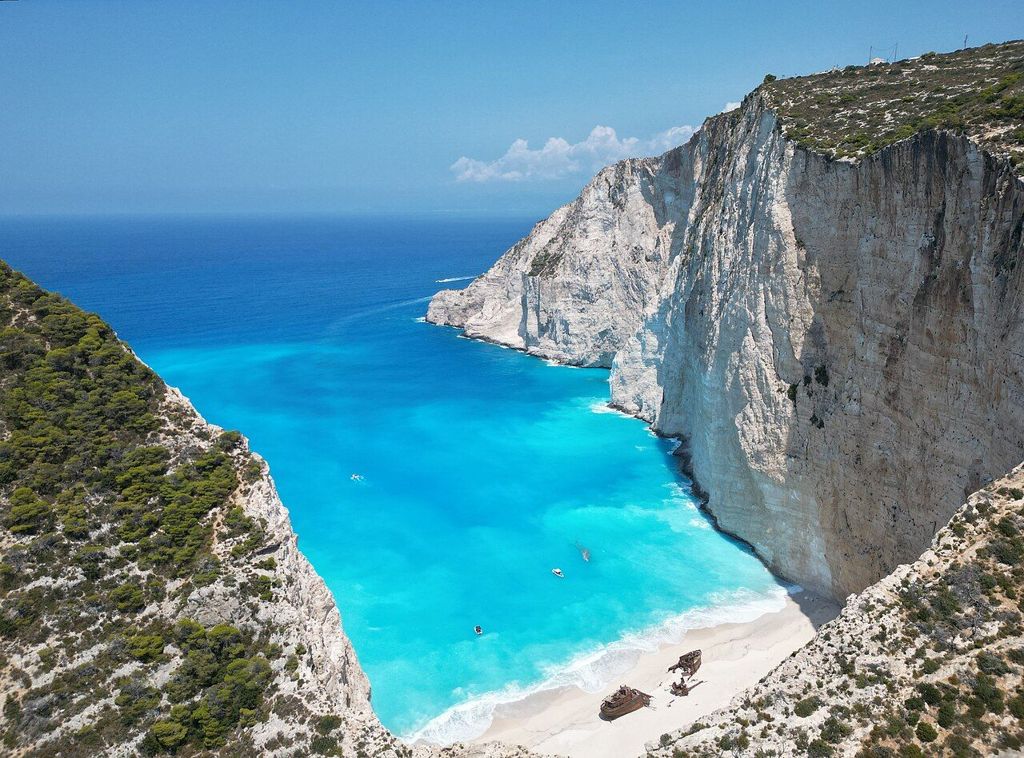
Navagio from the cliff top
A rusting ship lies on a pale beach at the foot of sheer cliffs. The famous view of Navagio is from above, and the edge deserves respect.
| Best months | May, June, September, October |
|---|---|
| Getting there | Road west through Anafonitria, then on foot |
| Bring | Sturdy shoes, water, hat, wide-angle lens |
| Beach rule | Stay behind the barriers at the viewpoint; the cove below may be closed after rockfalls, so check first. |
Navagio, the Shipwreck cove, lies on the north-west coast of Zakynthos, where the island ends in white limestone cliffs that drop straight into the sea. In a narrow bay between two headlands sits a beach of pale pebbles and sand, and on it the rusting hull of a small cargo ship. The water around it ranges from bright turquoise near the shore to deep blue further out.
This is one of the most photographed coastlines in Greece, and most of those photographs are taken from the cliff top, high above the cove. This guide is about that view: how to reach it, how to stay safe at the edge, and what to know about the beach below.
The ship and the cove
The wreck is usually said to have run aground in a storm around 1980, and stories about smuggled cargo have followed it ever since. Over the decades the hull has rusted and broken, and the sea and the weather keep changing it. The cove was once called Agios Georgios, after a nearby monastery, but the name Navagio, simply Greek for shipwreck, has replaced it in everyday use.
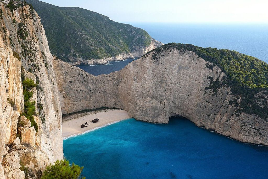
The cliffs that enclose the bay rise to around two hundred metres. They are layered limestone, pale grey and cream, streaked darker where water runs down them. From above you see the full shape of the cove, the ship as a small dark shape on the sand, and boats arriving and leaving like toys.
The colour of the water is the other half of the picture. The bed of the cove is pale sand and fine limestone gravel, washed down from the cliffs over thousands of years, and it reflects light up through the shallow water near the shore. Further out the sea deepens quickly, and the turquoise gives way to a dark, even blue.
The viewpoint on the cliff top
The main viewpoint sits on the southern headland above the cove. A road runs there from the inland villages of the north-west, and the last part is on foot along a short track over rocky ground. A viewing platform with a barrier was built at the most popular spot. Facilities, parking arrangements and access can change, especially after work to make the area safer, so check before you go.
Away from the platform the ground is open. The rock is uneven and can be loose, and the drop is sheer. Wind gusts can be strong on the headland even on a calm day inland.
Further along: Keri's cliffs and lighthouse
Safety at the edge
People have been seriously hurt at Navagio by stepping too close to the edge for a photograph. A few simple habits keep the visit safe:
- Stay behind the barriers, and stay well back from the edge wherever there is no barrier.
- Wear shoes with grip. Sandals and flip-flops slip on the polished limestone.
- Do not sit with your legs over the edge or lean out for a better angle.
- Watch children closely and keep a hand on them near the drop.
- Do not fly a drone where it is not permitted; rules on drones change, so check them in advance.
- Stop and step back in strong wind.
The best photographs of Navagio come from the platform anyway. A wide lens fits in the whole cove, and a slightly longer one picks out the ship.
The beach below and rockfall closures
For many years, boats brought visitors down to the beach itself. After a large rockfall from the cliffs in 2018, access to the beach was restricted, and since then rules about landing and swimming in the cove have changed more than once. At times the beach has been closed to visitors entirely, while boats may still pass through the bay. The cliffs remain unstable, and further falls are possible.
Treat any plan to land on the beach as uncertain. Check the current situation before you go, follow instructions from the authorities and from boat crews, and never walk or swim close under the cliffs.
When to go and the best light
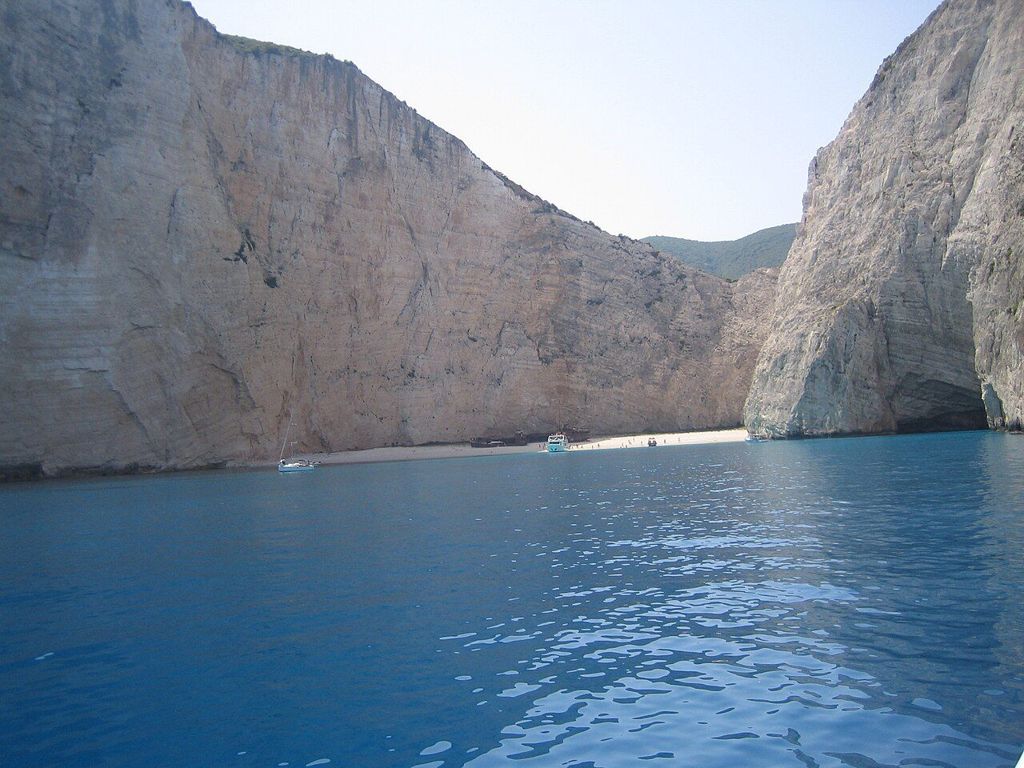
The cove faces west and north-west, so the light changes a great deal through the day. Around the middle of the day the sun reaches deep into the bay and the water glows its brightest. Late in the afternoon the cliffs warm in colour but parts of the cove fall into shadow. Morning is quieter at the viewpoint, before the coach groups arrive.
May, June, September and early October offer warm days without the heaviest crowds. In July and August the platform is busy for much of the day. In winter the viewpoint is still open to walkers in good weather, but the road and the track can be muddy after rain.
Haze is common on hot summer afternoons and can soften the colours. After a day of north-westerly wind the air is often clearer, and the view reaches further along the coast. Give yourself time at the viewpoint rather than arriving for a single photograph; the light shifts across the cliffs from minute to minute.
Combining Navagio with the north-west
The north-west of Zakynthos is a high, rural plateau of olive groves, small villages and stone walls. The monastery of Agios Georgios Kremnon stands near the coast not far from the viewpoint, and the village of Anafonitria has a monastery of its own. Further north, the island ends at Cape Skinari, where small boats visit the Blue Caves. The drive from Navagio to the cape is short.
On the other side of the island, the cliffs continue in softer form at the south-west cape, covered in our guide to Keri's cliffs and lighthouse. And for a quiet contrast after the crowds at the viewpoint, the south coast has the nesting beach at Gerakas.